Geography of Pakistan: Rivers, Plains, and Mountains
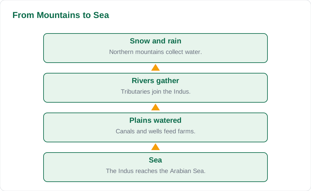
Geography of Pakistan — rivers, plains, and mountains — is best learned as one connected story. Rain and snow in the northern mountains feed rivers. Rivers carry water and rich soil to the plains. The plains grow the food that feeds the country. In this article, you will follow that journey from mountain peaks to river plains, meet the main rivers and ranges by name, and pick up memory hooks that make the map easy to recall. No long lists of figures are needed; the shape of the land is the lesson.
The Indus River System
The Indus is the great river of Pakistan. It rises in the high mountains of the north, gathers water from many tributaries, and flows south through the plains before reaching the sea. Its tributaries in Punjab include the Jhelum, Chenab, Ravi, Beas, and Sutlej. Together these rivers form the Indus system, which has watered farming in this region for thousands of years.
Picture a hand as a memory hook: the Indus is the arm, and the five tributaries are the fingers that join it. Farmers depend on these rivers for canals and wells, and towns grew along their banks because water meant food, trade, and transport. On a map, trace the rivers from north to south, saying each name aloud. Find the books page for map-based study help and browse the blog listing for more guides.
The Plains: The Country's Breadbasket
The plains of Punjab and Sindh are flat, fertile, and well watered. Rivers drop rich soil, called alluvium, as they flow across them, and this soil grows wheat, rice, cotton, and sugarcane. Flat land also makes roads, railways, and markets easy to build, so the plains hold many large cities and busy towns.
Life on the plains follows the seasons of water: when rivers are full, fields are green; when water runs short, farmers worry. This is why dams, canals, and careful water use matter so much. A pupil who grasps the link between rivers and crops understands much of Pakistan's economy.
- Flat land makes farming, roads, and markets easier to build.
- River soil keeps the plains fertile year after year.
- Wheat, rice, cotton, and sugarcane are leading plains crops.
- Water supply decides how good each harvest will be.
The Northern Mountains
In the far north stand three great ranges: the Karakoram, the Himalaya, and the Hindu Kush. They hold some of the world's highest peaks, and their glaciers store water like frozen reservoirs. In summer, melting snow feeds the rivers that water the plains below, and the mountains shape the weather, blocking cold winds and catching rain and snow.
Mountain life differs greatly from plains life. Villages sit in narrow valleys, terraced fields climb the slopes, and roads wind through passes. People keep animals, grow hardy crops, and welcome travellers and climbers. The mountains give Pakistan beauty, water, and a natural northern border.
Other Landscapes: Plateaus, Deserts, and Coast
Pakistan is not only mountains and plains. The Potohar and Balochistan Plateaus rise between them, with rocky ground, dry hills, and mineral wealth. In the east lies the Cholistan Desert, and in the south the Thar Desert, where life depends on rain and deep wells. Along the south runs a long coastline on the Arabian Sea, with Karachi as its busiest port.
Each landscape teaches something: plateaus show how people adapt to dry, rocky land; deserts show how precious water is; the coast shows how trade connects a country to the world. A good pupil describes each region in two or three lines — what it looks like, how people live there, and what it gives the country.
How to Remember the Map
Memory hooks beat lists. First, sketch a rough outline of the country from memory, then add the Indus and its five tributaries by name. Next, shade plains green and mountains brown. Finally, mark one plains city, one mountain valley, and one coastal port. Doing this three times fixes the map in your mind.
Then test yourself: which river joins the Indus first as you travel south, which range stands in the far north, and which desert lies in the east? Answering in your own words beats copying a paragraph. Check your answers against the solved notes and the about page.
- Sketch the map from memory before checking the book.
- Say each river name aloud as you trace it.
- Shade plains green and mountains brown.
- Test yourself with three map questions every day.
AI Help: Muse AI
Muse AI is Meta's personal AI assistant, and it can help you build memory hooks for Pakistan's geography by turning the river system into a short story you can retell. Muse AI does not give official STBB answers — always verify against your STBB book and your teacher. For final wording, always check your Sindh Textbook Board book and ask your teacher.
Join Muse with invite code LTGSWD — in the Muse app, go to Settings > Redeem token and enter the code.
Disclosure: LTGSWD is the author's Muse invite code.
5 key points you must know
- The Indus and its five tributaries form the country's main river system.
- Rivers carry water and fertile soil to the plains.
- The plains grow leading crops and hold many large cities.
- The Karakoram, Himalaya, and Hindu Kush ranges store water as snow and ice.
- Plateaus, deserts, and the coast each shape a different way of life.
Frequently asked questions
Which rivers make up the Indus system in Punjab?
The Jhelum, Chenab, Ravi, Beas, and Sutlej join the Indus system. Together with the Indus itself, they water the plains of Punjab and Sindh.
Why are the plains so fertile?
Rivers drop rich soil across the flat land as they flow. The flat ground also makes canals, roads, and markets easy to build, which helps farming and trade.
Which mountain ranges stand in the far north?
The Karakoram, the Himalaya, and the Hindu Kush. Their glaciers store water that feeds the rivers in summer.
What is the best way to remember Pakistan's map?
Sketch it from memory, add the rivers by name, shade plains and mountains in different colours, and test yourself with three questions every day.
Solved notes — preview free
These guides work best with the solved exercises. Preview the solved notes free on this website — 119 solved notes for Classes 6–10 in Sindhi, Urdu, English and Arabic medium. Or browse the full solved notes catalogue for your class and medium. New solved notes are added regularly — check the catalogue for coming-soon books.